
LiDAR
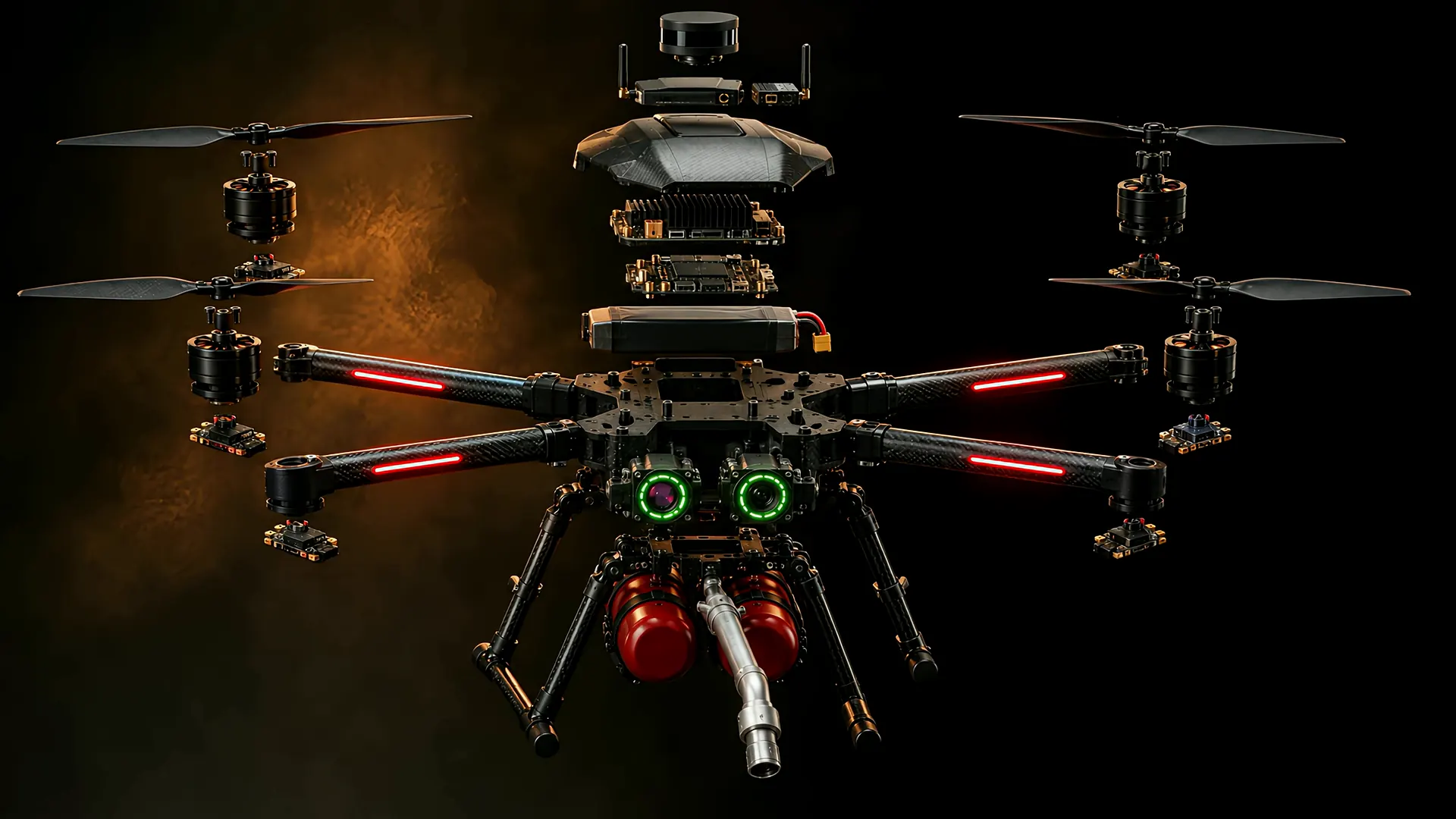
Scans the scene in three dimensions. Fused with the thermal picture, it puts structure and heat in one map: walls, openings and the fire's core.
Technology
Eleven systems, one job: working inside the smoke. Scroll to take it apart.
Concept design · AI-generated render
Part by part
This page is for the people who need to know how it really works: fire officers, engineers and investors doing diligence. It is written to be checked.
Scans the scene in three dimensions. Fused with the thermal picture, it puts structure and heat in one map: walls, openings and the fire's core.
Opens the operator interface from anywhere with coverage, and lets any firefighter on scene open the live drone view on a phone. It adds reach; command stays on the local radio.
A long-range local radio to the ground station. This is the command path, and it works with no internet at all.
The onboard AI computer. Runs perception and mission logic on the aircraft and advises the flight computer as a guest, never as its master.
Handles stabilisation, position control and every failsafe. If the AI brain restarts, the aircraft keeps flying and keeps its failsafes.
The main flight pack, monitored continuously. A low pack sends the aircraft home before it becomes a problem.
Four brushless motors sized with headroom for a full suppressant load, not for a showroom spec sheet.
Electronic speed controllers, one per motor, turning flight-computer commands into precise motor power hundreds of times a second.
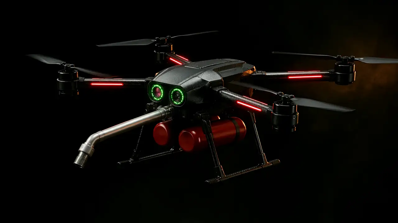
Long-wave infrared sees heat where the eye sees only smoke: the fire's core, hot spots and people.
A visible-light camera with onboard recognition that marks fire, smoke and people for the operator in real time.
Twin suppressant pods and a nozzle angled 45° down for a directed cone. The pod set is the unit of resupply, swapped at the nest.
Architecture
A flight controller running an open-source autopilot handles stabilisation, position control and every failsafe. A Linux companion computer alongside it runs perception, mission logic and the link to the ground, and talks to the flight controller only over a serial MAVLink connection, as a guest.
The split matters. The companion can crash, hang, or be rewritten mid-project and the aircraft still flies, still holds position and still executes its failsafes, because nothing in the stabilisation loop depends on it.
That is the difference between an autonomous aircraft and a Linux box with propellers.
Autonomous flight runs through the autopilot's offboard mode. We confirm the aircraft actually entered that mode by decoding the raw mode bits out of the MAVLink heartbeat, not by string-matching a rendered mode name, because the rendered name is UNKNOWN for several perfectly valid combinations, and trusting it produced takeoff commands that silently did nothing.
The estimator's local origin is re-established at every boot, so an altitude of “one metre” means a different climb on each power cycle. We latch the last disarmed altitude as a ground datum and command every climb relative to that. Navigation commands from the map carry position only: a click says where, never how high.
A long-wave infrared array and a visible camera stream to the ground station over a low-latency lane. A compact convolutional detector runs GPU-accelerated against that feed and raises hotspot alerts. Every alert is written with position, altitude, heading and flight mode attached.
Safety doctrine
Every rule below is enforced in configuration, not in intention. They are the rules we will not trade away for a smoother demonstration, because the person they protect is standing at the launch point holding the transmitter.
A physical radio-control transmitter is the command truth. Autonomy is subordinate to it at every instant of every flight. There is no mode in which the aircraft cannot be taken manually, and there is no demonstration important enough to change that.
We do not lengthen loss-of-link timeouts to hide a weak radio, and we do not disable a safety check to clear an arming refusal. If the aircraft refuses to arm, we read the reason it gives and fix that reason.
Loss of the command path commands a return, not a hover. An aircraft holding position over a fire until its battery expires is a falling object with a countdown, and the countdown is the only part anyone can predict.
Over 5G the operator interface opens from anywhere, carrying the live map, video and mission commands, and every firefighter on scene can check the drone's view from their phone. The long-range local radio and the physical transmitter stay underneath it as the command authority: if the 5G link drops or the network is saturated, failsafes take over and the pilot on scene can take the aircraft manually at any instant.
Data
The aircraft opens a flight record when it arms and closes it when it disarms. Bench arms are discarded automatically by peak altitude, so the dataset does not fill up with test runs that never left the table.
| Captured | Rate | Why it is worth capturing |
|---|---|---|
| Full telemetry | 2 Hz | Position, altitude, attitude, mode, battery, satellites: the flight envelope actually flown, not the one planned. |
| Command round-trip | 2 Hz | Latency to the aircraft against range. This is the measurement that decides what radio the production aircraft needs. |
| Video health | 2 Hz | Frame rate and stream state against range, so link degradation has a distance attached to it rather than an impression. |
| Detection events | on change | Every alert stamped with position, altitude, heading and mode. This is the labelled set the detector will be retrained on. |
We will send raw flight records to anyone doing serious diligence. Checking our arithmetic is encouraged; it is the fastest way for both of us to find out whether this is real.
Request flight data